
A monster wildfire tearing through southwest France grew so powerful that its smoke column became a thunderstorm – generating lightning which ignited a slew of new fires.
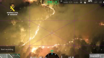
Apocalyptic new images taken following the outbreak of a fire near Saumos, in France’s Gironde department, show a terrifying wall of smoke stretching into the sky for miles. The now 162-square mile blaze ignited on July 22, and has rapidly eaten away at the community.
Like many others that have formed in the nation and its neighbour Spain over the last two weeks, it has forced people to flee for safety, with 240 homes abandoned and 220,000 people evacuated so far.
The Saumos fire is notably different from its fellow fires, however, as it has become dangerously self-sustaining. According to scientists, it has prompted a phenomenon named the pyrocumulonimbus – which typically are only able to develop in the most extreme environments.
A pyrocumulonimbus, otherwise known as pyroCb, is rare in Europe, as they tend to spawn in the generally more extreme conditions seen in North America and Australia. Even there, the fire-fuelled storm clouds are only created in the most intense fires. They have never before been encountered by firefighters in France, according to the country’s national firefighters federation.
The departmental fire and rescue service said it had generated a pyrocumulonimbus just two days after spawning, with heat and smoke surging upward into a vast black, electrified thundercloud.
Theodore Giannaros, a fire meteorologist at the National Observatory of Athens, explained the firestorms are generated by a mix of extreme heat, smoke and moisture. He said: “Imagine a campfire so large and hot that the smoke rising off it turns into a storm-like cloud. That is a pyroCb — a storm cloud born from the intense heat that a wildfire produces.”
Pyrocumulonimbus do not form at a set temperature, instead requiring very hot, very dry air near the ground, with cooler and moister air above it.
Hot air loaded with smoke and moisture then rises rapidly from the flames. As it climbs and cools, water vapor condenses around particles of ash. Above the freezing level, droplets become ice crystals whose collisions separate electrical charges, as in an ordinary thunderstorm.
Mr Giannaros added:“It’s a feedback loop, not a one-way effect. Once it forms, the cloud becomes its own weather system, sitting on top of the fire and making it harder to predict.” The systems can also spin up whirling columns of flame — usually a fire whirl, which Giannaros describes as a dust devil made of fire and heat instead of dust.
In Europe, pyroCbs have been rare, with Portugal recording one during its deadly 2017 fire season. France has now joined the list as the nation’s wildfire crisis only deepens.
The fires are only expected to get worse in the days to come, with a looming 40C heatwave making more wildfires likely and creating even more difficulty for firefighters tackling existing blazes. Around 300,000 people have been displaced in the last week alone, and the country’s president, Emmanuel Macron, has said the crisis is the worst France has faced since World War Two.
Macron said the Gironde blaze was “unprecedented”, during a visit to the departmental fire and rescue operational centre (CODIS) in blaze-hit Bordeaux, adding: “The weeks ahead will be difficult and we must hold on.”